Resources
About Us
LiDAR Drones Market by Survey (Topographic LiDAR, Bathymetric LiDAR), Type (Wing Drones, Rotary Drones), Range (Tactical, Medium, Long), End User (Agriculture, Construction, Power & Utilities, Mining), End User and Geography - Global Forecast to 2032
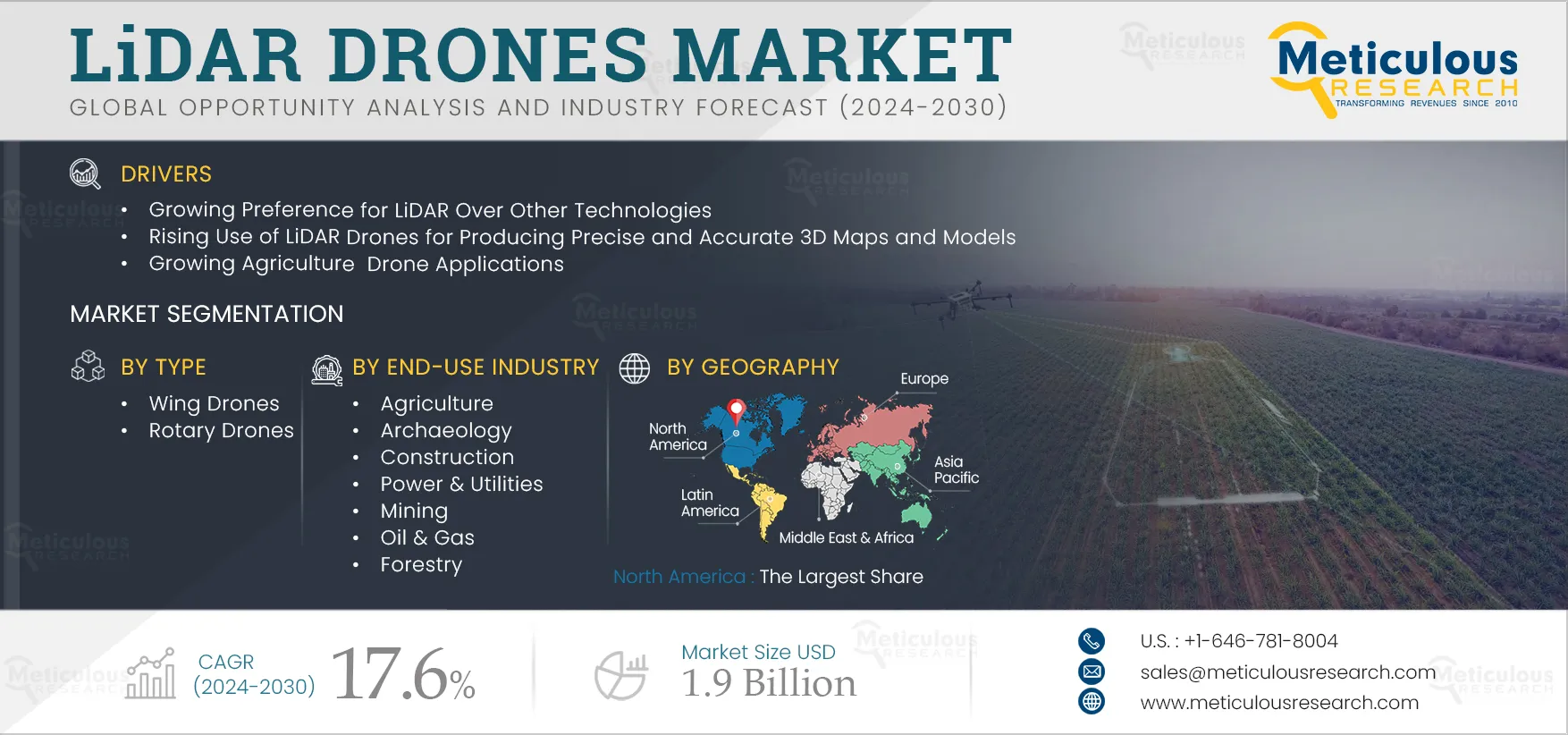
Report ID: MRSE - 104814 Pages: 300 Jan-2025 Formats*: PDF Category: Semiconductor and Electronics Delivery: 24 to 72 Hours Download Free Sample ReportThe LiDAR Drones Market is projected to reach $1.9 billion by 2032, at a CAGR of 17.6% during the forecast period of 2025 to 2032.The growth of this market is attributed to the growing application of LiDAR drones in land surveying, construction site monitoring, and environmental monitoring; the rising use of LiDAR drones for producing precise and accurate 3D maps and models; and growing agriculture drone applications. Furthermore, the increased use of LiDAR for environmental purposes and the emergence of 4D LiDAR sensors are expected to create significant opportunities for this market. However, the high cost of LiDAR drones hampers the growth of this market. In addition, the inability to function through heavy rain, snow, and fog is a major challenge to the growth of this market.
The global LiDAR drones market is segmented based on survey method, type, range, end-use industry and geography. The study also evaluates industry competitors and analyses the regional and country-level markets.
Key Players:
The key players profiled in the global LiDAR drones market study include Ouster, Inc. (U.S.), Teledyne Geospatial (Canada), RIEGL Laser Measurement Systems GmbH (Austria), Phoenix LiDAR Systems (U.S.), YELLOWSCAN (France), SICK AG (Germany), DELAIR SAS (France), UMS SKELDAR (Switzerland), mdGroup Germany GmbH (Germany), draganFLY INC (Canada), Geodetic Systems, Inc. (U.S.), Cepton, Inc. (U.S.), PrecisionHawk, Inc. (Canada), SureStar (Beijing), and SZ DJI Technology Co., Ltd. (China).
Click here to: Get Free Sample Pages of this Report
Over the last few years, the growing popularity of drones in applications such as power line inspection, topographic mapping, emergency response, and agricultural & forestry surveys has boosted the global demand for LiDAR technology. The integration of modern mapping technologies and navigation & positioning systems has increased the benefits of Unmanned Aerial Vehicle (UAV) offerings. Compared to other technologies, such as traditional surveying or photogrammetry, LiDAR is less affected by weather conditions and can be used in a wider range of lighting conditions. Additionally, LiDAR technology can provide more accurate and precise data than other methods, reducing the need for costly rework or additional data collection.
Multiple industries are increasing their use of LiDAR technology for accurate mapping & object detection as the range of surveys has increased significantly. Manufacturing companies are focused on developing cost-effective LiDAR technologies for UAVs. For instance, in April 2021, Shanghai Huace Navigation Technology Ltd. (China) launched the most cost-effective, accurate, and lightest LiDAR system, AlphaAir 450 (AA450), for UAVs. The system is suitable for power line inspection, topographic mapping, emergency response, agricultural & forestry surveys, and many other applications. Moreover, in April 2021, drone manufacturing giant SZ DJI Technology Co., Ltd. (China) developed its affordable LiDAR drone system, Zenmuse L1, for aerial drone LiDAR mapping. Advances in LiDAR drone systems have enabled several industries to generate spatial data, map elevation, and analyze land morphology in dangerous environments, such as in the aftermath of earthquakes and floods. Thus, the advance in LiDAR is expected to drive the growth of the global LiDAR drones market
Based on Survey method, the Topographic LiDAR Segment is Expected to Dominate the LiDAR Drones Market
Based on survey method, the global LiDAR drones market is segmented into topographic LiDAR and bathymetric LiDAR. In 2025, the topographic LiDAR segment is expected to account for the largest share of the market. In 2025, the topographic LiDAR segment is expected to account for the largest share of the market. The largest market share of this segment is attributed to the growing utilization of near-infrared laser beams for mapping land and buildings, increasing applications in military, civil engineering, and governments for determining the weather conditions, gathering information on the landmass, and in agriculture for crop growth. However, the bathymetric LiDAR segment is projected to register the highest CAGR during the forecast period.
Based on Type, the Rotary Drones Segment is Expected to Dominate the LiDAR Drones Market
Based on type, the global LiDAR drones market is segmented into wing and rotary drones. In 2025, the rotary drones segment is expected to account for the largest share of the market. The large share of this segment is attributed to rotary drones’ ability to have better control over position and framing for aerial photography and surveillance. Additionally, having more than one motor makes it capable of flying more closely to structures and buildings, increasing its operational efficiency and reducing inspection time. Rotary drones are widely used in various industries and applications, including aerial photography, surveying and mapping, search and rescue operations, and military and defense operations. They are typically small and agile, making them well-suited to fly in tight spaces and navigate challenging environments. However, the wing drones segment is projected to register the highest CAGR during the forecast period.
Based on Range, the Tactical Range Segment is Expected to Dominate the LiDAR Drones Market
Based on range, the global LiDAR drones market is segmented into tactical range (up to 130 m), medium range (130m-230 m) and long range (more than 230m). In 2025, the tactical range segment is expected to account for the largest share of the LiDAR drone market. The large share of this segment is attributed to the growing need to enable safe unmanned aircraft operations by providing a reliable and cost-effective way to detect turbulence, wind shear, volcanic ash, supercooled liquid clouds with icing risks, and high ice water content clouds from unmanned aircraft in real-time. However, the long range segment is projected to register the highest CAGR during the forecast period.
Based on End-use Industry, the Agriculture Segment is Expected to Dominate the LiDAR Drones Market
Based on end-use industry, the global LiDAR drones market is segmented into agriculture, archaeology, construction, power & utilities, mining, oil & gas, forestry, and other end users. In 2025, the agriculture segment is expected to account for the largest share of the LiDAR drones market. The largest share of this segment is attributed to the need for aerial imagery from drones for livestock management, rising demand for drone technology among farmers to make more accurate data-driven agriculture decisions, and a surge in need to minimizing soil erosion and improving plant health monitoring and irrigation.
In 2025, North America is Expected to Dominate the LiDAR Drones Market
Based on geography, the global LiDAR drones market is segmented into North America, Europe, Asia-Pacific, Latin America, and the Middle East & Africa. In 2025, North America is expected to account for the largest share of the market. In North America, various initiatives are being undertaken to propel LiDAR drones adoption for safety and environmental application purposes, increasing investments by key players to enhance LiDAR drone-based geoscience data collection, mapping, data preservation, and scientific interpretation of areas with potential for critical minerals. LiDAR drones are used extensively in North America for various applications, including land surveying, infrastructure inspection, natural resource management, and environmental monitoring. However, Asia-Pacific is projected to register the highest CAGR during the forecast period.
Scope of the Report:
LiDAR Drones Market, by Survey Method
LiDAR Drones Market, by Type
LiDAR Drones Market, by Range
LiDAR Drones Market, by End-use Industry
LiDAR Drones Market, by Geography
Key Questions Answered in the Report:
The global LiDAR drones market is segmented based on survey method, type, range, end-use industry, and geography. The study also evaluates industry competitors and analyses the regional and country-level markets.
The global LiDAR drones market is projected to reach $1.9 billion by 2032, at a CAGR of 17.6% from 2025 to 2032.
Based on type, in 2025, the rotary drones segment is expected to account for the largest share of the LiDAR drones market.
Based on end-use industry, in 2025, the agriculture segment is expected to account for the largest share of the global 5LiDAR drones market.
The growth of this market is attributed to the growing application of LiDAR drones in land surveying, construction site monitoring, and environmental monitoring; the rising use of LiDAR drones for producing precise and accurate 3D maps and models; and growing agriculture drone applications. Furthermore, the increased use of LiDAR for environmental purposes and the emergence of 4D LiDAR sensors are expected to create significant opportunities for this market.
The key players profiled in the global LiDAR drones market study include Ouster, Inc. (U.S.), Teledyne Geospatial (Canada), RIEGL Laser Measurement Systems GmbH (Austria), Phoenix LiDAR Systems (U.S.), YELLOWSCAN (France), SICK AG (Germany), DELAIR SAS (France), UMS SKELDAR (Switzerland), mdGroup Germany GmbH (Germany), draganFLY INC (Canada), Geodetic Systems, Inc. (U.S.), Cepton, Inc. (U.S.), PrecisionHawk, Inc. (Canada), SureStar (Beijing), and SZ DJI Technology Co., Ltd. (China).
The Asia-Pacific is expected to grow at the highest CAGR during the forecast period.






















Published Date: Jan-2025
Published Date: Oct-2024
Published Date: Aug-2024
Please enter your corporate email id here to view sample report.
Subscribe to get the latest industry updates